Hurricane Irene - Wind Forecast

From the statistics of all historical storm tracks and storm strengths, I have developed a method
to forecast wind exceedence probabilities given a current
storm position, velocity and maximum sustained wind.
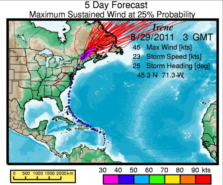
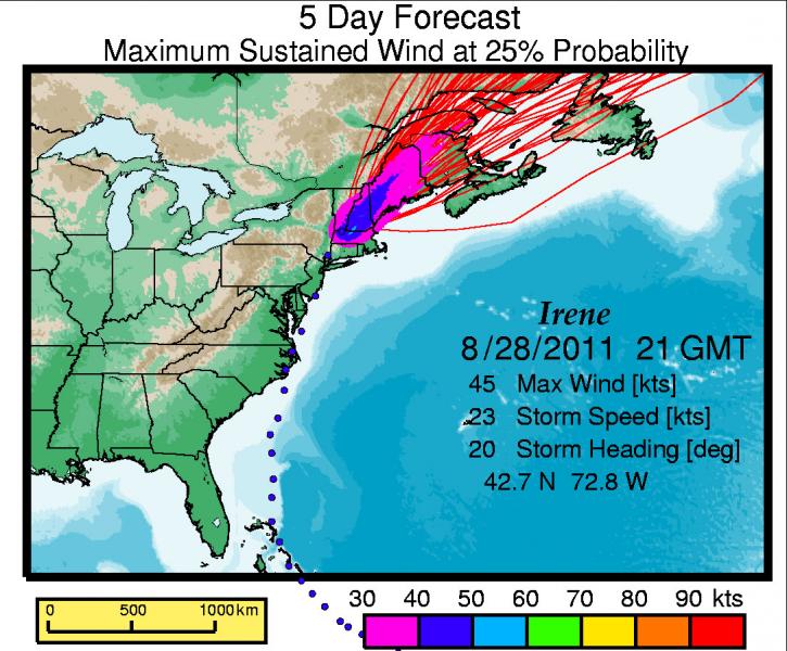
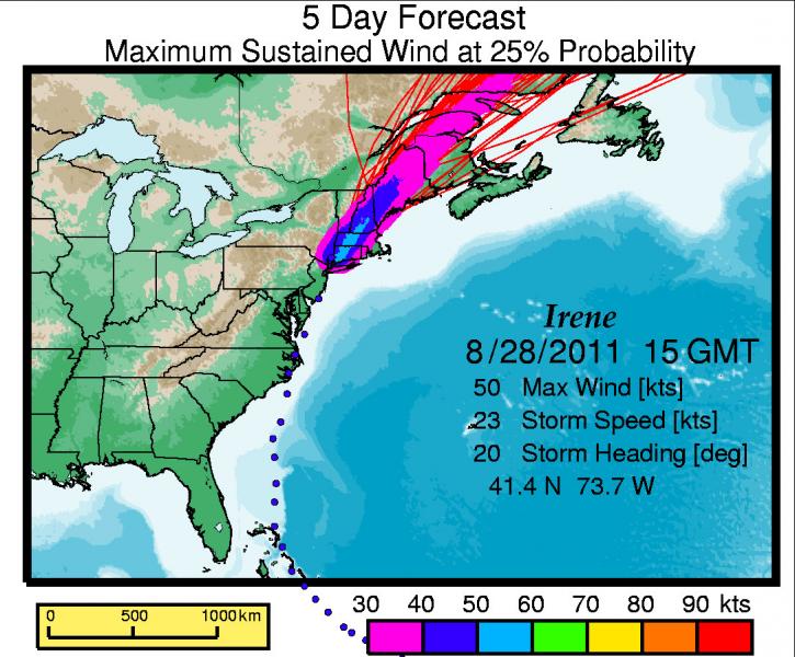
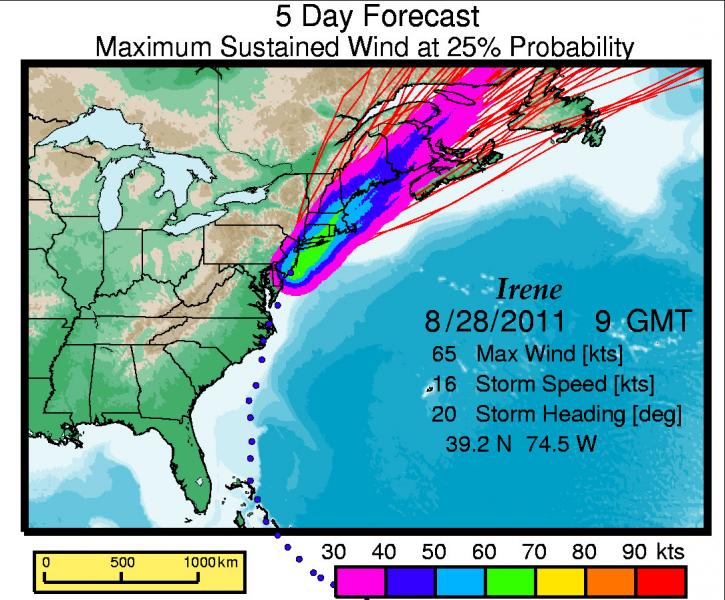
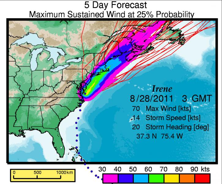
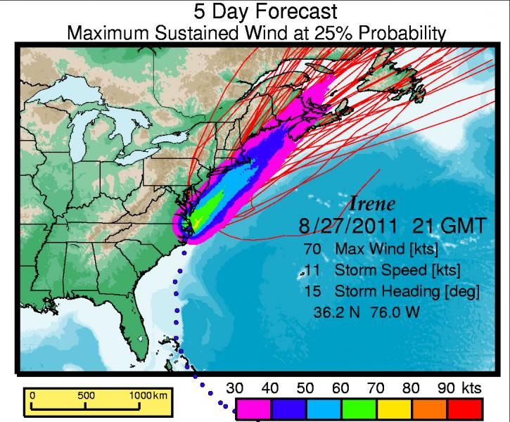
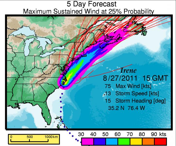
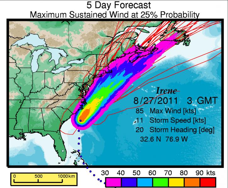
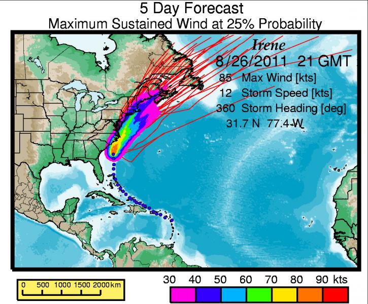
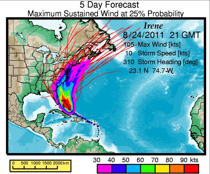
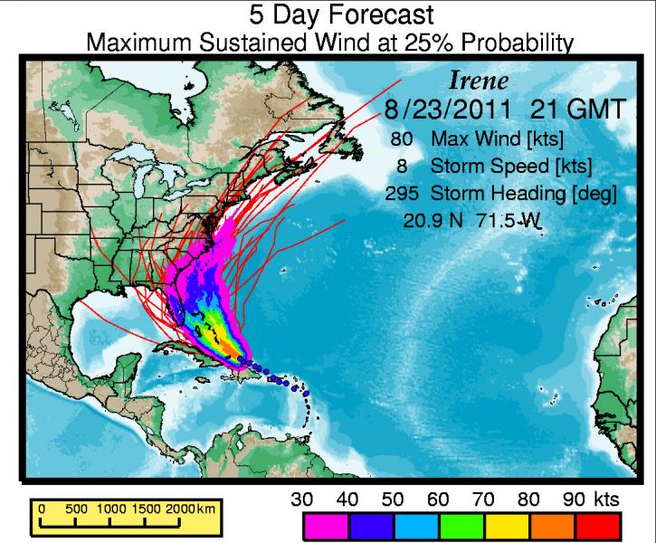
Here is a recent forecast for Hurricane Irene. Red lines are potential tracks based on previous storm statistics and current storm parameters. By running many potential tracks, wind exceedence probabilities can be deduced.
Colors on the maps below plot the Maximum Sustained Wind at 25% probability for the next five days. Probabilistic forecasts like these can be used to evaluate quantitatively potential wind losses as the storm progresses.
From 8/29/2011 3 GMT
From 8/28/2011 21 GMT
From 8/28/2011 15 GMT
From 8/28/2011 9 GMT
From 8/28/2011 3 GMT
From 8/27/2011 21 GMT
From 8/27/2011 15 GMT
From 8/27/2011 3 GMT
From 8/26/2011 21 GMT
From 8/25/2011 21 GMT

From 8/24/2011 21 GMT
From 8/23/2011 21 GMT
Steven N. Ward Santa Cruz
About OpenHazards Bloggers
 Steven Ward is a Research Geophysicist at
the Institute of Geophysics and Planetary Physics, UC Santa Cruz. He specializes in the quantification and simulation of
natural hazards. Read Steve's blog.
Steven Ward is a Research Geophysicist at
the Institute of Geophysics and Planetary Physics, UC Santa Cruz. He specializes in the quantification and simulation of
natural hazards. Read Steve's blog.
 John Rundle is a Distinguished Professor of Physics
and Geology at UC Davis and
the Executive Director of the APEC Collaboration for Earthquake Simulations. He
chaired the Board of Advisors for the Southern California Earthquake Center from 1994 to 1996. Read John's blog.
John Rundle is a Distinguished Professor of Physics
and Geology at UC Davis and
the Executive Director of the APEC Collaboration for Earthquake Simulations. He
chaired the Board of Advisors for the Southern California Earthquake Center from 1994 to 1996. Read John's blog.
Comments
This is the thing we need to have in order to get the gta v money gta5moneycheats.com online whenever we want the generator.
No doubt, while you are in tough condition like Safari nights, forest journey then It's difficult to measure the weather. I also searching any new toolset for this purpose that how I can measure the air pressure as well as weather condition so I read about that you have developed a method to forecast wind exceedence probabilities given a current storm position so truly I am very happy and use this NinjaEssays to measure and getting some experience. Thank you so much for introduce this new gadget.
Thank you for the read. Honestly you covered the topic and broadly examined all areas. If i was to write this i would have done a few things differently myself but you have definitely inspired me to get into the world of blogging. Thanks heaps for the post i really appreciate it. Have a good day and keep blogging Wow, I'm a lefty too and i dont know if all that it true but still WOW! i never knew all those ppl wer leftys cuz i aint american essay so yea. but still, nice work n u shudna put the jealousy part.... just sayin......I really like your modern stylish ideas which you have shared about manipulative. This blog provide extraordinary and exact information for which I was searching.